The Tanner Trail begins at the South Rim just east of Lipan Point and descends about ten miles to the Colorado River, making it Grand Canyon’s longest South Rim to river trail. A prehistoric alignment once dropped from the Palisades west of Desert View down to the top of the Redwall Limestone, then more or less followed today’s route to the river. This path was well known to the Navajos, and to the Hopis who might use it to access the salt mines and other resources along the Colorado River after visiting their Havasupai friends at Supai.
When Hopis guided Garcia López de Cárdenas and his band of conquistadores to the South Rim in 1540, they understood that the Spaniards wanted to reach the river to see if it might prove a viable way to return to Mexico. The guides had no real interest in helping the invaders, however, and failed to mention this relatively easy, nearby trail that Cárdenas could have used to examine the river and obtain much needed drinking water.
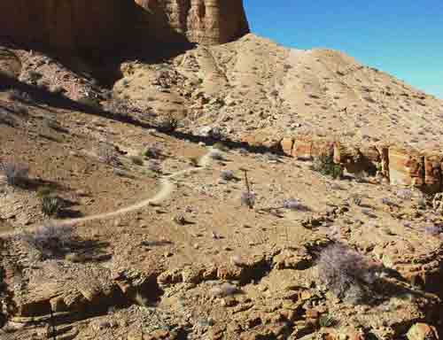
The trail through the lower Supai and below the Redwall Limestone to the river is relatively gentle with good traction, but completely exposed to the sun.
Seth Tanner was a Mormon scout and homesteader along the Little Colorado River, prospector and miner within Grand Canyon, and in later years, a guide in northeastern Arizona.
Grand Canyon Museum Collection, Catalog # GRCA 7060A.
Today’s upper alignment as far as the Redwall is named for Seth Tanner, a Mormon frontiersman who made the long trek to the Great Salt Lake with Brigham Young in 1847, then served as a scout for Mormon expansion to the Pacific Ocean before settling along the Little Colorado River in 1876. His little homestead was known as Tanner’s Crossing, the only place along the river’s banks for many miles where travelers could cross free of quicksand. The crossing was abandoned soon after 1911, when the Bureau of Indian Affairs built a suspension bridge a few miles west and redirected roads to that location—today’s Cameron, Arizona.
Seth Tanner had many interests, one of which was guiding regional visitors around northeast Arizona, and another, prospecting within Grand Canyon. He filed a claim to one of the earliest mining properties within the canyon in 1877, called the Tanner Ledge.
During the 1880s, Tanner and another prospector/guide named Franklin French (who married Emma Lee, the widow of John D. Lee) built the new trail alignment from Lipan Point to the top of the Redwall. By 1890 Tanner and two more prospectors named Lewis Bedlins and Fred Bunker improved the trail down to the river, and for many years thereafter it was known alternately as the Tanner-French Trail, Bunker Trail, and French Trail until common parlance settled on the Tanner Trail. These early prospectors, as well as Ben Beamer, Felix Lantier, and no doubt others used the Tanner in association with the Beamer and Hopi Salt Trails to form a circular prospecting route. They scoured the side canyons and river’s banks from Nankoweap Creek within Marble Canyon downriver as far as the Unkar Delta, and worked a few claims, but produced little ore.
The Tanner Trail figures in several canyon legends. There is good reason to believe that it served as the southern leg of a larger “horse thief trail,” whereon, several residents of the Arizona Strip would drive stolen horses down the Nankoweap Trail (built by John Wesley Powell and Charles Walcott in 1882) then south along the Tonto Platform and down Lava Canyon to the river, ford the river, then follow the Beamer and Tanner Trails up to the South Rim and on to Flagstaff. After selling the horses, they would steal others at the South Rim and drive them in the opposite direction to Fredonia and Kanab. Cash was hard to come by on the Arizona Strip, and not all Mormon residents were religious.
Artifacts found by today’s backpackers along this route lend credence to this story, as does one of the horse thieves’ descendents, who was proud to relate his grandfather’s ingenuity.

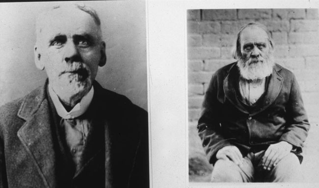
Franklin H. French and sons Charles and Frederick. French prospected with Seth Tanner, helped build the Tanner Trail, guided around the Grand Canyon region, and married Emma
Batchelor after her husband John D. Lee was executed in 1877 for his role in the Mountain Meadows Massacre.
Northern Arizona Pioneers Historical Society, Catalog # NAPHS 666-22.
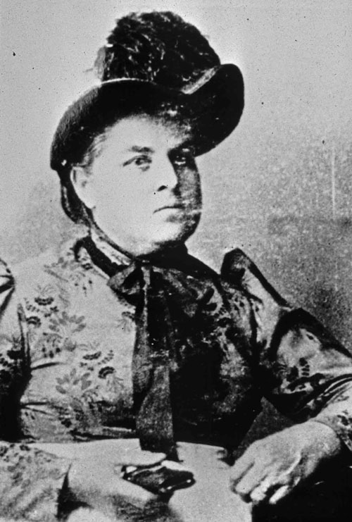
Emma Batchelor Lee (circa 1890) homesteaded the Lonely Dell Ranch at Lees Ferry, 1871-79. She ran the ferry across the river as much as her husband, and after John D. Lee’s execution in 1877, held onto the ranch until selling to the Mormon Church. She later married Franklin French and moved to Winslow, Arizona where she practiced home medicine and was known as Doctor French.
Northern Arizona Pioneers Historical Society, Catalog # NAPHS 666-33.
One eyewitness account of the thievery is associated with yet another local legend, “John D. Lee’s lost gold mine.” In the 1890s, South Rim pioneer Bill Bass and writer George Wharton James traveled down the Tanner Trail in search of this mine, or gold cache, which, the story goes, rested behind a waterfall in Tanner Canyon. They encountered a group of hard-looking men driving horses up the trail, had a few words, then continued on, but soon thought better of leaving their horses at the trailhead. Sure enough, when they hurried back to the rim to check, their horses were gone along with the strangers. Lee’s gold was never found, although some still search for it. For the record, Lee’s movements are well documented from the 1850s through his death in 1877, and he never ventured near the South Rim of Grand Canyon.
The Tanner Trail also figures in the Great Deer Drive of 1924, a true story that could only originate in the Wild West. By the early 1920s, residents of the South Rim, Flagstaff, and Williams had hunted the region’s mule deer to near extinction, while predator control efforts led to a surfeit of deer on the North Rim that threatened the ecological balance of the Kaibab Plateau. South rim residents offered a couple dollars per head to anyone who would transport deer from the Kaibab to the Coconino Plateau surrounding Flagstaff to jump start recovery, and the challenge was taken up by George McCormick. McCormick had prospected around the Nankoweap and Tanner Trails in the past, and some said (behind his back) that he knew the horse-thief route quite well. He hired all the local Indians and out-of-work cowboys on the Arizona Strip, strung them out as if driving tigers in the Far East, and had them converge at the Nankoweap Trailhead in the midst of a raging thunderstorm. Zane Grey filmed the epochal event, but when the effort failed to turn up a single deer, threw the film away in disgust. The Kaibab’s forest supervisor described the experience as the most interesting failure he had ever witnessed. How McCormick planned to “drive” deer through the Grand Canyon over more than 30 miles of rugged trail remains a mystery, but some deer were trucked and later flown from rim to rim by the Park Service and Grand Canyon Airlines in the 1920s and 1930s.
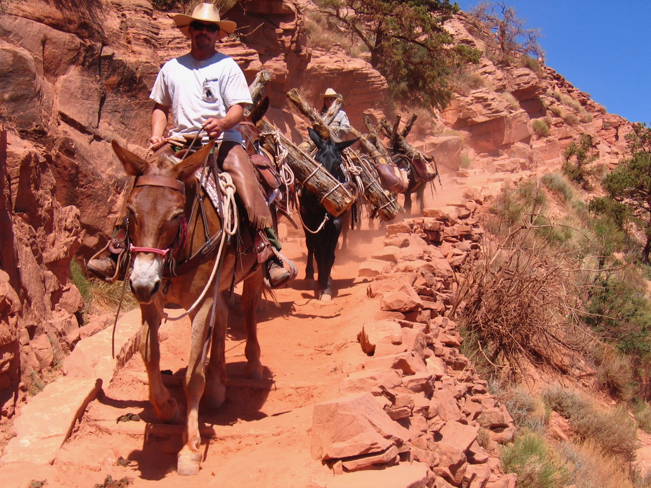
Like most of Grand Canyon’s pioneer trails, the Tanner was abandoned by the 1930s when its builders and early users had gone, but was later resurrected before nature could fully reclaim it. Park rangers began to check these trails in the early 1950s to determine if they could be used as emergency exits for the burgeoning number of rafters paddling and motoring down the Colorado River. The Tanner was checked several times in conjunction with the Hopi Salt and Beamer Trails by ranger Dan Davis and a few others, who reported that its deteriorated condition precluded stock use but might be used by hikers. The trail was improved through use after the 1960s when more and more backpackers learned of its existence, but it is still considered a wilderness trail and is rarely touched by the park’s trail crew.
Today, the Tanner Trail is a popular route to the river for dedicated backpackers, and to the Little Colorado River via the connecting Beamer Trail; however, it should not be taken lightly. There is no water along its 10-mile length, and most of it is exposed to the hot sun in summer months. People who have gone down without water or a map (or otherwise unprepared) have died of thirst or from falls. Get a park service permit, be prepared, and enjoy some of the best views in the canyon. Consider caching extra water at the top or base of the Redwall on the way down so you have a halfway camp on the way back up, and remember that if you continue along the Beamer, you cannot camp within ¼ mile of the mouth of the Little Colorado River.

The trail through the lower Supai and below the Redwall Limestone to the river is relatively gentle with good traction, but completely exposed to the sun. Expect real heat in these lower formations in summer.
National Park Service, Michael F. Anderson Collection
Written By Michael F. Anderson
- Michael F. Anderson is the author of Living at the Edge: Explorers, Exploiters and Settlers of the Grand Canyon Region (Grand Canyon Association, 1998) and Polishing the Jewel: An Administrative History of Grand Canyon National Park ( Grand Canyon Association, 2000).