The Arizona Strip is a vast arid region on the north side of the Grand Canyon that encompasses a variety of landscapes and climates within its nearly 3 million acres, as well as centuries of human history. The extreme difficulty of crossing the Canyon isolates the Strip from the rest of the state to which it belongs, yet this remote area has played an important role in the natural and cultural history of the Canyon.
Artifacts dating back 8,000 years indicate the long human habitation of this harsh landscape. Though Native Americans from ancient Puebloans to modern Paiutes have lived in the area for centuries, in most European and Euro-American eyes the area north of the Grand Canyon has always seemed more remote and isolated than that to the south. For example, while Europeans first visited the South Rim of the Grand Canyon in 1540, not until 1776 did a European record a visit to the North Rim when Spanish missionary Father Escalante passed through the area.

The section of Arizona north of the Grand Canyon is known as the Arizona Strip. Its natural and cultural features tie it closely to the biology, geology, and history of Grand Canyon National Park.
Credit: Canyons, cultures and environmental change: An introduction to the land-use history of the Colorado Plateau. http://www.cpluhna.nau.edu/
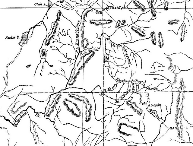
Escalante’s Route from Santa Fé to Utah Lake passes through the Arizona Strip, which is in the lower left of the map above the Colorado River.
Credit: Wikimedia Commons
Early 19th century Spanish colonies in northern New Mexico and southern California were linked by a trail that ran through the Arizona Strip. The route, originally used by Native Americans for trade and migrations, became a pathway connecting Santa Fe and Los Angeles starting in 1829 when Antonio Armijo retraced the route Father Escalante had taken through the region half a century earlier. This route was designated as a National Historic Trail in 2002, and is jointly administered by the U.S. Bureau of Land Management (BLM) and National Park Service. However, neither Spanish nor Mexicans established significant settlements in the Arizona Strip.
Early Euro-American settlers came to the region in the mid-1800s primarily to establish sheep and cattle ranches. They were attracted by the variation in elevation across the Strip, which meant both summer and winter ranges were available within a relatively short distance.
Most of the newcomers were Mormons who were wary of intrusions by outsiders and government agencies, and therefore resisted the types of development that transformed other areas of Arizona and the West, such as railroads and industrial mining outfits. However, they tended to choose the best land and water resources, bringing them into conflict with local Navajo and Paiute populations.
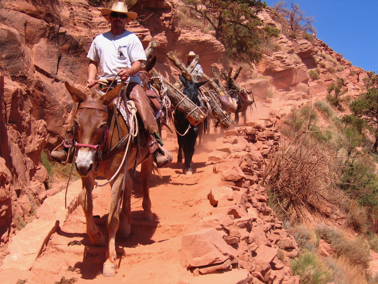
Famous explorers and scientists in Grand Canyon history, such as John Wesley Powell and Clarence Dutton, camped at the site of the modern town of Fredonia in the Arizona Strip. Men traveling with Powell’s 1871 expedition found flakes of gold in the area, causing a small gold rush there, but miners quickly decided that the extremely hard work involved was not worth the meager results.
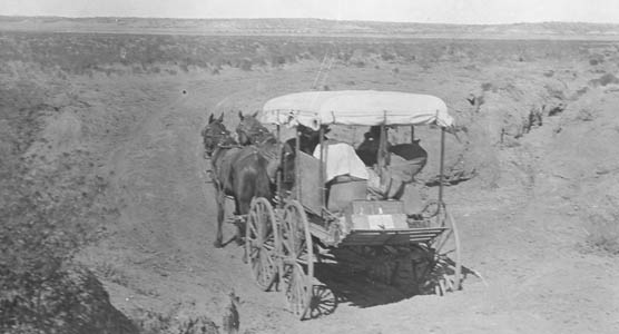
Tourists have traveled through the Arizona Strip for decades in order to experience its unusual scenery and history, sometimes on their way to Grand Canyon. Fortunately today visitors do not have to do it by horse and buggy like this couple in 1913.
Credit: J. Cecil Alter. NPS Photo.

Euro-Americans began establishing settlements in the Arizona Strip in the 19th Century. Even though people were far removed from major population centers, education was important, as this historic schoolhouse shows.
Credit: BLM/Arizona Strip Field Office.
Even though the area was isolated and sparsely populated, in the late 19th century it became a source of contention between two young territories, Arizona and Utah, both of which claimed the area north of the Canyon as their own. The issue was finally solved when Arizona became a state in 1912 and Congress confirmed the strip as belonging to Arizona, creating a square northwestern corner as a boundary rather than the Colorado River. But because the Arizona Strip is difficult to reach from the urban centers of Arizona, except by crossing or driving around the Grand Canyon, and because most of the roads in the area head north into Utah, the strip is historically, culturally, and economically more connected to Utah and Nevada than to Arizona.
Though it is not included in the boundaries of Grand Canyon National Park, the Arizona Strip is connected to its ecosystem. The only year-round stream in the entire Strip is the Virgin River, which flows into the northwest tip of Lake Mead.
Vegetation ranges from cacti and creosote to grassland and sagebrush, juniper and pinyon forests, and even ponderosa pines, spruce, fir, and aspen trees on the Kaibab Plateau. The Strip contains cliffs, canyons, and valleys that fluctuate from low desert ranges to pine-covered mountains. It also contains features such as volcanic cones and basalt flows that contribute to further understanding of the geological story told at Grand Canyon.
Although most of the area is considered a “high-desert” environment, it is biologically diverse with 387 species of animals living there, though some species are restricted to specific habitats. Wildlife includes bighorn sheep, mountain lions, desert tortoise, Kaibab squirrel, coyote, and many kinds of snakes and lizards. Over 100 species of birds can be found in the area as well, including the California condor and golden eagle.
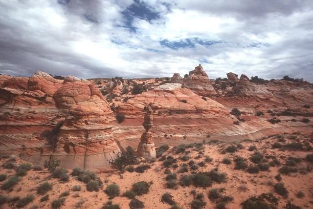
Many of the rock formations, layers, and colors, such as these at the Paria Canyon-Vermilion Cliffs Wilderness, resemble those seen at Grand Canyon National Park.
Credit: BLM/Arizona.
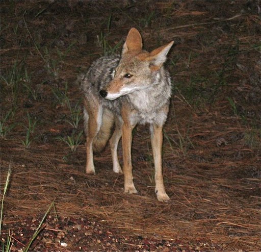
The adaptive and intelligent coyote thrives on the Arizona Strip.
Credit: Paul Hirt
Despite the early wrangling for control of the Arizona Strip, even after statehood the land remained relatively unused except for the Kaibab Paiute Reservation (created in 1913), a few Mormon settlements, and roaming livestock herds. Occasionally, a hardy tourist would travel through the remote area, including the famous Arizona historian, politician, author, and activist Sharlot Hall. In 1911 she spent ten weeks in the Strip, keeping a diary of her trip that was later published as Sharlot Hall on the Arizona Strip: A Diary of a Journey Through Northern Arizona in 1911. She called the area “Arizona’s Unknown Treasure Land,” stating that “The wild grandeur and beauty of the region is beyond description; virgin forest, bank upon bank of spruce and fir on mountainside and canyon wall, towering yellow pine over the more level plateau, quaking aspen that are giants of their race in the shallow canyons—and narrow, grassy flower-sown parks that run like natural roadways back and forth over the whole region” (Crampton, 1975: 88).
For many years cattle ranching comprised the main economic activity in the Strip. One outfit, the Grand Canyon Cattle Company, ran over 100,000 cattle in the region at the turn of the 20th century. In the arid landscape, however, competition for resources like water and forage led to small range wars between cattlemen and sheepmen and led as well to overgrazing of the rangelands. Private and government land managers today are still trying to restore degraded ecological conditions from decades of overuse.
These economic activities made the Arizona Strip the site of a significant environmental disaster in the early 20th Century. In 1906, President Theodore Roosevelt decided to establish the Grand Canyon National Game Preserve on the Kaibab Plateau to protect game species there, including an estimated 5,000 deer. Stockmen, concerned about protecting their investments in cattle and sheep, convinced the government to exterminate predators such as mountain lions, coyotes, and wolves that threatened their livestock. Hunters were happy to oblige, since they received a bounty for killing these animals. At the same time, livestock ranching was declining in the area, leaving more range on which deer could browse.
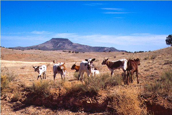
Ranchers have grazed livestock on the Arizona Strip since the late 1800s. In the early years they mostly grazed sheep but changed to cattle in the 20th century. Livestock numbers in the region peaked between after World War I stayed high until the Great Depression.
Credit: NPS Parashant National Monument http://www.nps.gov/archive/para/photos/Cows_Diamond.jpg

White-tail deer calmly graze at Phantom Ranch to the delight of tourists.
Credit: Paul Hirt
This combination of events led to an explosion in the deer population on the Kaibab Plateau far beyond the carrying capacity of the land. Estimates of the number of deer there in 1924 range from 26,000 to 100,000, compared to just 5,000 eighteen years before. Thousands died of starvation. This alarmed officials, who believed they needed to take quick action to avoid a catastrophic collapse of the deer population. A variety of solutions were proposed, including trapping and shipping deer to other areas and increasing deer hunting permits. The National Park Service disliked these ideas because park managers believed the deer helped attract visitors to the North Rim. The NPS finally agreed to allow some hunting, which is otherwise illegal in the national parks, but a surfeit of deer remained on the Kaibab plateau. Eventually the state and federal governments hatched a plan to herd thousands of deer off the North Rim, down into the Canyon, swim them across the Colorado River, and drive them up to the South Rim where they would serve as tourist attractions. Gawkers of this extraordinary event included Zane Grey, who wrote The Deer Stalker based on what he saw, and D.W. Griffith, who brought a film crew to record the spectacle though they were thwarted by blizzard conditions. The feat was accomplished by seventy-two Navajo on foot and twenty-five Euro-Americans on horseback who all tried to herd the flighty wild deer. Though apparently amusing to watch, the event was not a success.
In the end, this situation helped wildlife managers better understand the interconnected nature of ecological systems, and led to new policies concerning wildlife management. Today, wildlife numbers in federally protected areas are carefully managed to try to balance the many competing needs of the various life forms that inhabit these landscapes. Grazing still occurs today outside the national park boundaries, but the Bureau of Land Management regulates it according to changes in vegetation and rainfall.
Apart from ranching, other schemes to make the area economically productive have largely failed. Large scale logging started in the late 19th century to help construct settlements in the area. Smaller logging operations have continued off and on into the present time, though today the federal government carefully monitors the use of forests. Around the turn of the 20th century mining efforts on the Strip focused on copper deposits in the Shivwits Plateau and Parashant Canyon area and silver in the Mt. Trumbull area, though they were not major producers. More recently companies explored the area for uranium, even doing some drilling, but little uranium development has occurred there. In 1906 the first oil well in the Grand Canyon area was drilled on the Arizona Strip. By 1961 seventeen more had been drilled, but none were productive.

Hiker exploring Soap Canyon near the Vermillion Cliffs.
Credit: Paul hirt
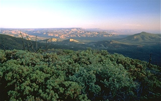
The Arizona Strip contains some of the most rugged public land in the continental United States.
Credit: BLM/Arizona
Since the 1970s, recreation and tourism have played an increasingly important role in the economy of the Arizona Strip. The primary landowner on the Arizona Strip is the federal government and these publicly-owned lands are open to a wide variety of outdoor recreation activities. The BLM, Forest Service, and NPS manage most of the land on the Strip. In fact, the BLM alone manages over two-thirds of the Strip, which they describe as “among the most remote and rugged public land in the lower 48 states.” Several National Wilderness Areas (Beaver Dam Mountains, Grand Wash Cliffs, Kanab Creek, Mount Trumbull, Mount Logan, Paiute, and Paria Canyon-Vermilion Cliffs) and National Monuments (Grand Canyon-Parashant, Vermilion Cliffs, and Pipe Spring,) are located there, as well as Lake Mead and Glen Canyon National Recreation Areas, Kaibab National Forest, and the North Rim of Grand Canyon National Park. A remote and unforgiving land once feared and shunned has grown to be loved and protected by the American people. This transformation of use reflects not just evolving economic opportunities, but a slow, steady reformation of American attitudes toward nature.
The BLM, created in 1946 with the merger of the U.S. Grazing Service and General Land Office, was originally designed to manage public lands that were not under the jurisdiction of any other federal agency. Though it initially focused on determining policies for grazing, mining, timber, oil and gas development on public lands, after 1976 its role expanded to include the management of recreation and wilderness resources as well. The BLM today tries to balance the needs of animals and plants on the Arizona Strip with other uses for the land such as livestock grazing, mining, logging, and recreation.
Much like Grand Canyon National Park, the Arizona Strip is so remote and rugged that only a small percentage of its lands (about 3%) have been surveyed for cultural and paleontological resources. In 2005, the BLM funded a study of Native American cultural history and place names on the Strip with the primary goal of identifying and understanding Paiute views and use of the land from historical times to the mid-20th century. Protecting cultural resources, wildlife, and wilderness is difficult to balance with competing calls to open up BLM lands to more development, roads, and motorized recreation. As a “multiple use” agency, the BLM historically leaned much more toward development than preservation, though in recent years that bias has weakened.
Visitors to the Arizona Strip can appreciate its scenic overlooks, picturesque vistas, historic sites and prehistoric petroglyphs and ruins. Most of the highways in the area follow historic routes used by succeeding waves of people from Native Americans to Spanish and Euro-American settlers to modern tourists. Evidence of the movement and folding of rocks is everywhere in a landscape full of layered, twisted, coarse and burnished stone. Though outside Grand Canyon National Park, the area has many similarities but enough differences to appeal to those who seek to understand the nature, culture, and history of the Grand Canyon region.

o the Grand Canyon, but different enough to add to their understanding of the complex geology of the region, and beautiful in its own unique way.
Credit: Paul hirt
Written By Sarah Bohl Gerke
References:
- Berger, Todd R. It Happened At Grand Canyon. TwoDot, 2007.
- Billingsley, George H., Earle E. Spamer, and Dove Menkes. Quest for the Pillar of Gold: The Mines and Miners of the Grand Canyon. GCA, 1997.
- Bureau of Land Management, Arizona Strip Field Office website: http://www.blm.gov/az/st/en/fo/arizona_strip_field.html
- Grahame, John D. and Thomas D. Sisk, eds. “Canyons, cultures and environmental change: An introduction to the land-use history of the Colorado Plateau.” 2002. Accessed 01/19/09. Available online at http://cpluhna.nau.edu/Places/arizona_strip.htm
- Hughes, J. Donald. “Scenery versus Habitat at the Grand Canyon.” In Anderson, Michael, ed. A Gathering of Grand Canyon Historians: Proceedings of the Inaugural Grand Canyon History Symposium, January 2002. (105-109) Grand Canyon Association, 2005.
- Krutch, Joseph Wood. The Grand Canyon: Today and All Its Yesterdays. Tucson: University of Arizona Press, 1989.