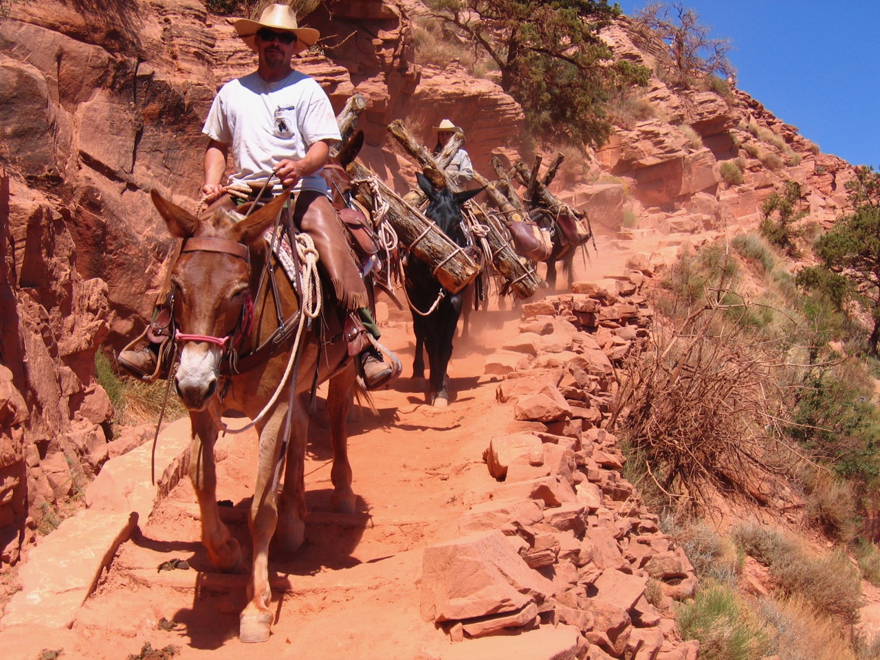

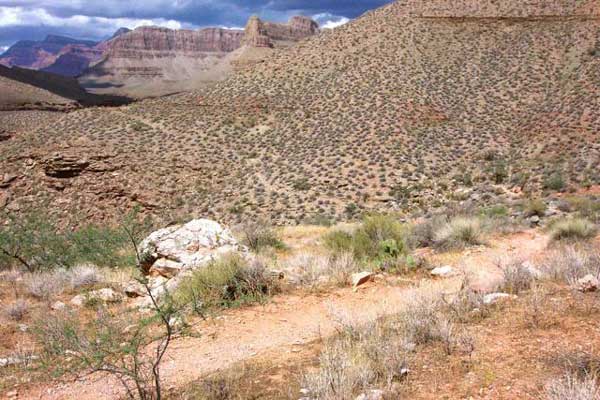
Tonto Trail surrounding the head of Copper Canyon. Bill Bass prospected and transported ore between his copper mines within this side canyon and from his asbestos Mine in Hakatai Canyon along this route to the South Bass Trail, thereby wearing the trail in this seven-mile segment of the Tonto Platform.
Photo: Grand Canyon National Park.
The Tonto Trail begins at the base of the New Hance Trail, just west of the mouth of Red Canyon at the Colorado River. It immediately climbs away from the river atop the emerging metamorphic schist for a few miles until reaching above the Tapeats Sandstone within the Bright Angel Shale just east of Hance Canyon. At this level, the trail begins its consistent pattern of heading side drainages and rounding mesas overlooking the river for 80 miles or more before ending abruptly at Garnet Canyon, about ten miles west of the South Bass Trail.
To understand the Tonto Trail, how and where it exists, and why it exists at all, first consider Grand Canyon geology. While many of the canyon’s rock layers erode in sheer cliffs and steep slopes, the mudstones, or shales, tend to erode far more easily, undercutting the layers above them and often forming “platforms” that are reasonably level compared to the rest of the inner canyon. For example, west of the North Bass Trail, the Hermit Shale’s erosion forms a platform on the much harder Esplanade, the top layer of the Supai Group.
It is possible to hike the “Esplanade,” as this platform is known, from the North Bass Trail as far as Toroweap many miles to the west, and because it was possible, and desirable to reach grasses and other inner-canyon resources, a trail was worn by prehistoric peoples and later cattlemen—today’s Tuckup Trail.
Similar geologic layers and processes occurred to the east between Red and Garnet Canyons on the south side of the river. The easily eroded Bright Angel Shale and to a lesser extent, the Muav Limestone, undercuts the harder Temple Butte and Redwall Limestones, and because it sits atop the hard Tapeats Sandstone, forms a reasonably level surface known as the Tonto Platform. Similar to the Esplanade, prehistoric canyon inhabitants found the Tonto Platform an ideal route to reach inner-canyon resources. Over time they developed many paths through use, evidenced by hundreds of archeological sites found along its entire length. Since the platform averages about 3,000 vertical feet below the South Rim, and perhaps 1,500 feet above the river, it also allowed countless inner-canyon shortcuts and loop paths for early inhabitants when used with the dozens of side canyons and other routes down from the South Rim and up from the Colorado River.
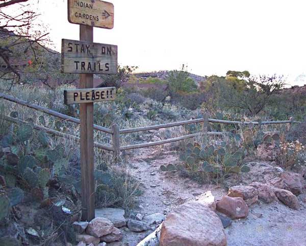
Vegetation of the Tonto Platform. Most of the trail lies within the Upper Sonoran life zone, with ubiquitous and uniform blackbrush in the open areas beneath towering mesas, but more diverse desert vegetation within side canyons, like here at Indian Garden.
Photo: Grand Canyon National Park.
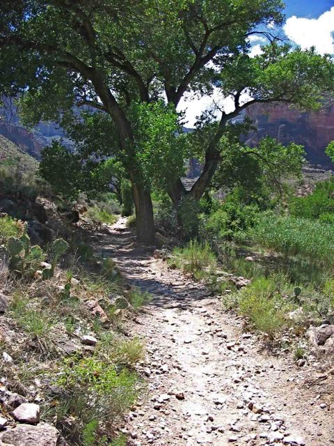
At least once per day, backpackers along the Tonto Trail will head into side canyons, more often than not offering water, shade, and good campsites.
Photo: Grand Canyon National Park.
When the first Euro-American mineral prospectors arrived in the central Grand Canyon area about 1880, they took advantage of many but not all of the travel routes used by Puebloan peoples and later historic tribes like the Havasupais. Because they rode horses and mules, unlike their pedestrian predecessors, they needed paths with gentler grades and greater widths to descend the canyon’s upper, cliff-forming, geologic formations. They improved the best of the Indians’ paths to accommodate their stock, but thereafter invested in formal, constructed trails only if they afforded access to promising prospecting routes, mining claims, or producing mines. Therefore, along the developed South Rim, only a few Puebloan and Havasupai paths emerged as Euro-American trails: the Tanner, New Hance, Old Hance, Grandview, Bright Angel, Waldron, and Dripping Springs-Boucher Trails. All but the Tanner descend to the Tonto Platform and all at one time continued to the Colorado River. Two additional South Rim trails—the Hermit (1912) and the South Kaibab (1925)—were added later to facilitate tourism, and they, too, reach the Tonto Platform and river.
The modern alignment of the Tonto Trail emerged as these early prospectors ranged along the Tonto Platform and up and down side canyons looking for minerals. Since they worked alone or with partners to build each of the rim-to-river trails, most of which they recorded as toll roads, and invested their time, energy, and money to maintain them, they developed a sense of proprietary right to a general area of the rim and inner canyon.
John Hance, for example, developed his first trail (called the “old” Hance Trail today) down Hance Canyon about 1883, and his later trail down Red Canyon—the New Hance—in 1895. He and others used these trails to reach the Tonto Platform then spread out east and west, but Hance used and explored the area between Red Canyon and Horseshoe Mesa the most and made the most mining claims. Therefore, during the years 1883-1907, he was most responsible for the Tonto alignment that emerged through repeated use.

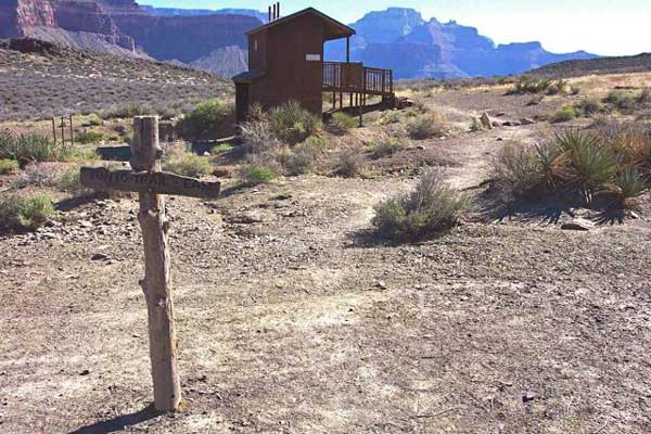
The park’s trail crew maintains a few backcountry toilets along the Tonto Trail. Here a crew member is working to replace an older pit toilet with a modern Romtec composting toilet at a secluded nook near the trail at Salt Creek.
Photo: Grand Canyon National Park.
The Tipoff, at the intersection of the Tonto and South Kaibab Trails. The Tipoff is a heavily visited and a strategic intersection, offering choices to ascend to the South Rim at Yaki Point (where hikers can then take the Greenway rim path to Grand Canyon Village), descend to the river to reach the Colorado River Trail, North Kaibab Trail, Clear Creek Trail, and Phantom Ranch, or travel east or west along the Tonto Trail.
Photo: Grand Canyon National Park.
This pattern of proprietary development of the Tonto Trail continued to the west. Ralph and Niles Cameron, Pete Berry, and a few other partners certainly had a lot to do with creation of the Tonto Trail from Hance Creek west to Garden Creek at Indian Garden through early prospecting trips, development of the Last Chance mining claims on Horseshoe Mesa, construction of the Grandview and Bright Angel Trails, and later tourism enterprises along the same route in the years 1889-1920. These men, along with Dan Hogan and Louis Boucher, also traveled the Tonto west toward Hermit Canyon; however, today’s trail from the Bright Angel to the Hermit is primarily owed to the Fred Harvey Company, whose wranglers led hundreds of tourist trips on what we now call the Hermit-Bright Angel Loop in the years 1912-1930. Louis Boucher rode the Tonto Platform from Hermit Canyon to some point beyond Boucher Canyon to the west in the 1890-1909 timeframe, and Bill Bass created the trail east and west of Bass and Copper Canyons in the years 1885-1917.
By the turn of the twentieth century, the Tonto Trail had been well defined by the early mineral prospectors, miners, and tourism operators. As the Grand Canyon Railway inched its way north from Williams towards the South Rim, these same men realized the impending boom to tourism and acted to secure their zones of influence through mining claims (most of them bogus) and, for those who had not already done so, by recording the trails they had built as toll roads. The most influential entrepreneur at the South Rim, Ralph Cameron, encouraged his friends like Louis Boucher to record their trails, and then proceeded to record every trail in sight that others had not recorded. In March 1902 he filed on the “River View Toll Road” atop the Tonto Platform from Red Canyon on the east to Slate Creek west of Boucher Canyon, perfectly describing the entire Tonto Trail except the western portion used by Bill Bass. Patterns of development at Grand Canyon Village and the range of Fred Harvey’s guided tours dictated the value of these proprietary trails, however, and only Cameron’s Bright Angel Trail ever merited erecting a gate and paying a toll keeper.
Tonto Trail between the Hermit Trail and Hermit Camp. The Hermit Trail descends to the Tonto Trail, then follows the Tonto for a mile or so before dropping down Hermit Canyon to the Colorado River.
Photo: Grand Canyon National Park.

Prehistoric and historic archeological sites are often passed along the Tonto Trail, like this stone corral at the abandoned Hermit Camp (1912-30). Take a break and marvel at these artifacts of past cultures and historic endeavors, but leave it all as you find it so others can enjoy it, too.
Photo: Grand Canyon National Park.
As the early Euro-American pioneers died or left the canyon they abandoned dozens of burros that they had imported to help with their prospecting and mining. The unemployed animals loved the Tonto Platform and bred prolifically, such that by the late 1920s, thousands ranged the inner canyon and, as humans had, realigned the Tonto Trail according to their own pursuit of resources. Since the feral animals damaged resources as they wandered and ate just about any vegetation that they came across, park administrators began to treat them as an “introduced” species. Rangers routinely carried rifles on their backcountry patrols during the 1920s and sporadically up until the late 1970s to shoot the feral burros on sight, but did not eliminate them until the early 1980s, when the remaining few were flown out by helicopter for adoption.
When backpacking became a popular pursuit in the 1960s, hikers reported a spider web of Tonto Platform paths, some left by prospectors, most by burros, and many leading to dead ends high up in the side canyons. Only after the burros had been removed did backpackers once again redefine one favored path according to their own needs and destinations. Today’s hikers follow one well-worn path intersecting with the trails coming down from the South Rim, but from high vantages may well glimpse earlier Indian, pioneer, and burro alignments fading from the platform landscape.

Photo: Grand Canyon National Park.

Ralph & Niles Cameron, Pete Berry, and other prospectors with a trace of humor established the “Hotel de Willow Creek” beneath a rock overhang along the Tonto Trail circa 1890.
Photo: Grand Canyon National Park.
Incorporating the Tonto Trail into your backpacking itinerary creates many pleasurable loop hikes ranging from 15 to 100 miles in length. It is nice to have a reasonably level day or more atop the Tonto Platform before struggling back up to the South Rim. The views are varied, in the morning rounding the mesas overlooking the river with grand views up to both rims; in the afternoon walking deeper into a side canyon to find a crossing, water, and a more intimate setting for camp. When you check with the park’s backcountry office, you can find which side canyons contain perennial creeks or dependable potholes for water, and which zones have at-large camping or require hikers to stay in designated campsites. But do not be fooled when making your plans. Distances along the Tonto appear short on a map, but regular meanders up each side canyon can double the time and distance to your destination.
Written By Michael F. Anderson
References:
- Anderson, Michael F. Living at the Edge: Explorers, Exploiters and Settlers of the Grand Canyon Region. Grand Canyon Association, 1998.
- Anderson, Michael F. Polishing the Jewel: An Administrative History of Grand Canyon National Park. Grand Canyon Association, 2000.
- Anderson, Michael F. “Grand Canyon National Park Toll Roads and Trails.” In Michael F. Anderson, compiler and editor. A Gathering of Grand Canyon Historians: Ideas, Arguments, and First Person Accounts. Grand Canyon Association, 2005.
- There are at least a dozen published Grand Canyon trails guides that include the Tonto Trail, many of which can be purchased through the Grand Canyon Association website.