
The Colorado River at the confluence of the Little Colorado River.
Photo: National Park Service
The Colorado River carves a distinct course through the depths of American cultural history. The river has been an important source of water and life for Native American groups for over 12,000 years, launched the business and adventure of modern river running, honed the political capabilities of the environmental movement through its battles against dams in the United States, and provided inspiration to noted American painters, photographers, songwriters, and authors.
Because of the carving forces of the Colorado River through the Grand Canyon, the river’s course tells the story of the earth’s formation and structure like few places on earth. We can learn much about the nature, culture, and history of the Grand Canyon and America by taking a closer look at this magnificent river.
The Colorado River cuts deeply into the geologic history of the Grand Canyon. The canyon’s depth varies from almost a vertical mile from Grand Canyon Village along the South Rim to the river to almost 6,000 feet at other locations along the canyon. The canyon’s width ranges from an average of 10 miles across near Grand Canyon Village but may be as wide as 18 miles across from rim to rim.
Over the past 6 million years, the Colorado River has carved through almost 2 billion years of the earth’s geologic history at the Grand Canyon. Layers of limestone, sandstone, shale, granite, and schist make up the Grand Canyon’s rock sequences. These layers continue to be worn away through water and wind erosio, creating the cliffs and slopes that make up this fantastic play of shape and color through time and space.
The diagram at right shows the layers of time that hikers and mule riders descend through on their way to the Colorado River. Visitors to the Canyon’s South Rim can learn more about the layers by walking the Trail of Time, scheduled for completion in October 2010. The two-kilometer interpretive trail begins at Yavapai Observation Station in present-day time and takes the visitor “back” a million years for each meter walked. Dr. Steven Semken, associate professor of Geoscience Education and Geological Sciences in the School of Earth and Space Exploration at Arizona State University, has collaborated on this long-term project with researchers from the University of New Mexico and the University of Massachusetts, as well as the National Park Service and National Science Foundation.
The USGS Web site has 3D tours of national parks, including one of the Grand Canyon, using historic images from John Wesley Powell’s Colorado River Expedition surveys from 18710-1879.
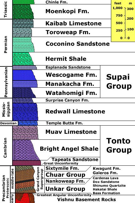
A geologic cross section of the Grand Canyon reveals a variety of rock layers.
Photo: U.S. Geological Survey
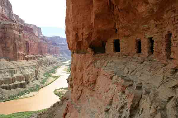
Granaries built by Ancestral Puebloans remain tucked into the cliff face above Nankoweap in Marble Canyon, Grand Canyon National Park.
Photo: Mark Lellouch, NPS.
The Colorado River is important to many Native American communities surrounding Grand Canyon National Park. For over 12,000 years, the river has been an important source of water and life for indigenous groups living in and around this vast canyon. Indigenous groups used the river’s water for agriculture and to fortify their lives in the canyon and along the rim.
Contemporary Havasupai, Hopi, Hualapai, Paiute, Navajo, Yavapai-Apache, and Zuni Tribes are active in decisions and discussions regarding the uses of the Colorado River. The Intertribal Council of Arizona includes over 20 Colorado River Indian Tribes that own more than one third of the allotment of water rights—717,000 acre feet of senior water rights to the Colorado River—in the state of Arizona.
For more information on tribes connected to Grand Canyon, see our Native Cultures page. Or visit the websites of Arizona tribes at the Intertribal Council of Arizona.
Although there are no dams inside the national park boundaries, two dams on the river flank the park and have a great influence on the plant and animal diversity, river flows, and human use of the Colorado River through the Grand Canyon and beyond. The Hoover Dam and Lake Mead were completed in 1936 at the lower or southwest end of the canyon. The Glen Canyon Dam, completed in 1963, lies at the upper end of the canyon near Lees Ferry and creates Lake Powell.
Cities and farms in the arid Southwest draw heavily from the Colorado River. More water is exported from the Colorado River than from any other river in the United States. Cities such as Los Angeles, Phoenix, Las Vegas, Denver, San Diego and many other communities draw water from the Colorado River basin for municipal and industrial uses. In addition, 2 million acres of land are irrigated by water from the Colorado River.
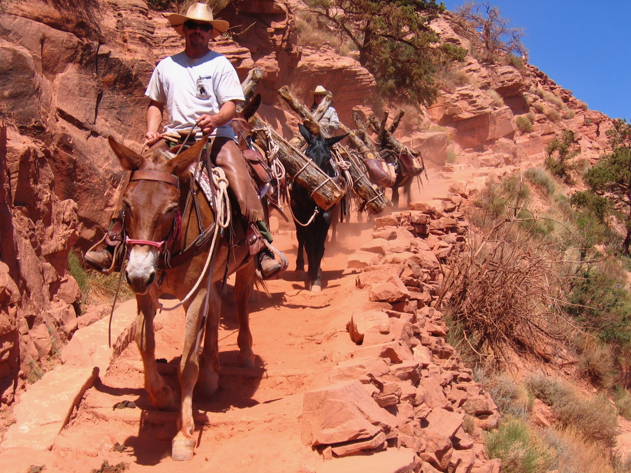
Some people are content to view the Grand Canyon from the rim. Others hike down into the inner gorge, camp or stay at Phantom Ranch. Still others think to truly experience the Canyon requires a trip down the turbulent waters of the Colorado River. Read about some famous river runners in Grand Canyon history on our Running the River page.
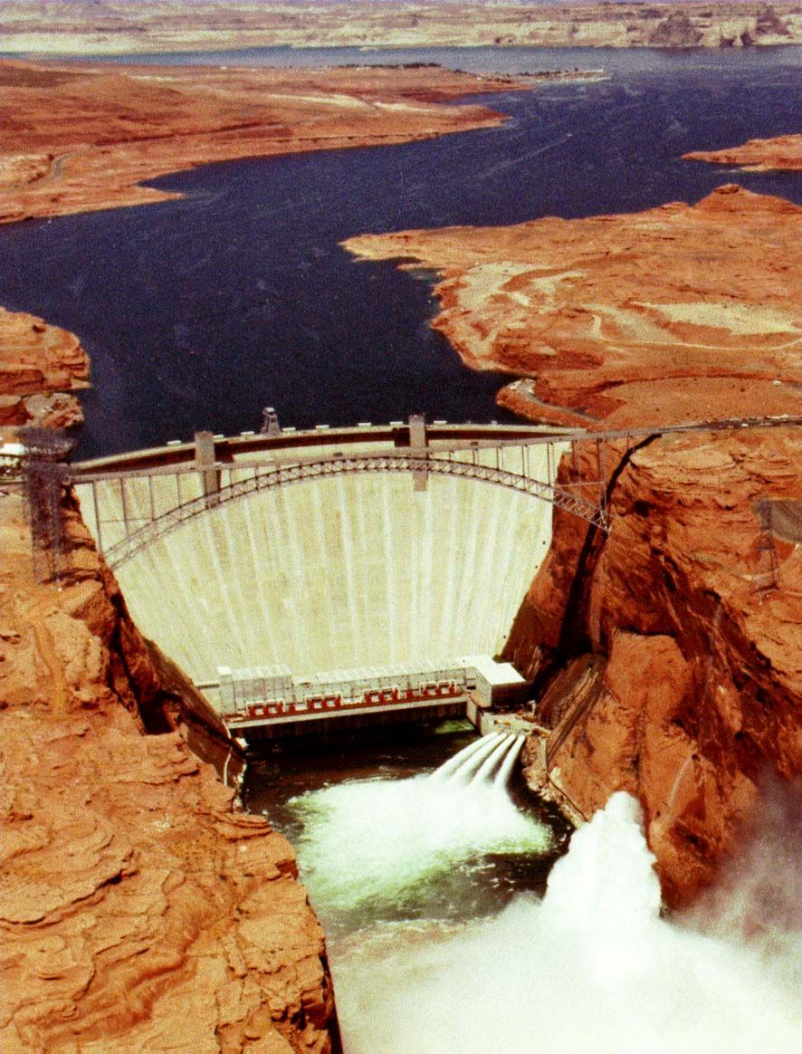
The Glen Canyon Dam lies on the upper end of the Grand Canyon.
Image courtesy of the U.S. Department of the Interior, Bureau of Reclamation. 1988. Photo # C45-300-21094