
An aerial view of Glen Canyon Dam, Lake Powell, and the town of Page, Arizona.
Photo: U.S. Bureau of Reclamation.
Beyond the northeastern end of Grand Canyon National Park, a manmade structure plays an important role in shaping the nature of the modern Canyon. One of two dams and artificial lakes that bookend the Grand Canyon, Glen Canyon Dam and Lake Powell have drastically changed the landscape and environment of this area of northern Arizona and southern Utah, as well as the Grand Canyon itself.
Lake Powell, which straddles the state line separating Arizona and Utah, is more than 500 feet deep in places. At full pool, Lake Powell holds 8.8 trillion gallons of water, making it the second largest manmade reservoir in the United States. Lake Mead, at the other end of Grand Canyon, has the largest capacity, 9 trillion gallons.
As the Colorado River backed up to form Lake Powell, it inundated several notable historical sites, such as the spot known as the Crossing of the Fathers, where two Catholic priests traveling to California in 1776 crossed the dangerous Colorado River at a ford. Almost 100 years later, John Wesley Powell stopped at the same site during his 1869 trip down the river because the spot provided a resting place for his party after traversing dangerous rapids. Powell at that time named the canyon that enclosed the spot Glen Canyon.
In 1972, while Lake Powell was still filling, Congress created Glen Canyon National Recreation Area. This area encompasses over 1.2 million acres of land and water on the Colorado Plateau. It shares its southern boundary with Grand Canyon National Park, and includes part of the Colorado River and surrounding land below the dam, as well as the dam itself and Lake Powell.
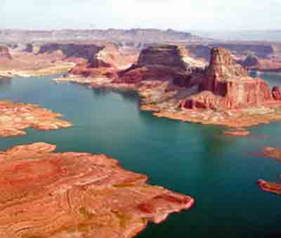
An aerial view of Glen Canyon Dam, Lake Powell, and the town of Page, Arizona.
Photo: U.S. Bureau of Reclamation.
Lake Powell at full pool, 1980.
Photo: U.S. Bureau of Reclamation.
Glen Canyon occupies one of the largest and most spectacularly remote wilderness areas in the United States. It is so large in fact that in 1936, before the creation of GCNRA, the National Park Service tried to protect a proposed 6,968 square miles of this land. What would have been the Escalante National Monument was supposed to cover roughly twice the area of Yellowstone National Park.
The bill eventually died by the efforts of the state of Utah and local ranchers, but it foreshadowed the great reclamation debates of the 1950s and 60s (See Glen Canyon Dam). GCNRA as it is known today did not officially come to fruition until 1972 through an act of Congress. The National Park Service is now responsible for the recreation and preservation of the over 1.2 million acres in its trust.
The Glen Canyon region has a rich history, and it is believed that people have been moving in and out of the region for the last 9,000 years.
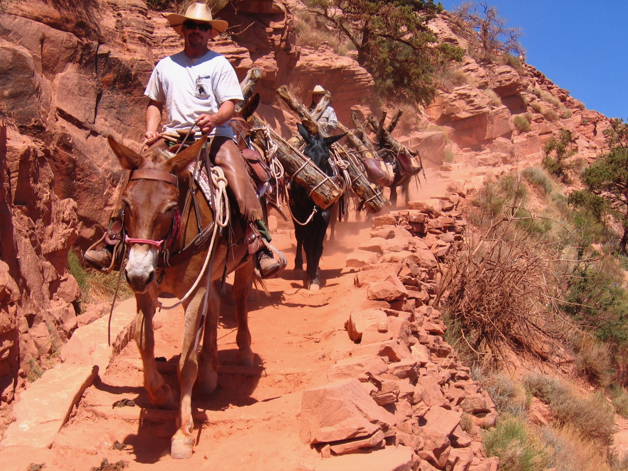
The earliest peoples were hunter gatherers, but as time progressed small-scale farming and irrigation developed. The typical crops of beans, squash, and maize were all grown in many of the Glen’s fertile side canyons. Today the Navajo retain the closest ties to the region as their reservation projects off the south end of GCNRA.
The first Europeans to come to the region, the Spanish, did not do so until the late 18th century, and were not followed again until the Mormons pushed into the region in the 19th century. At this time they were still limited to areas they could access by natural river crossings, and instead of using the crossing at Lees Ferry they decided to utilize a crossing called the Hole in the Rock as a means of pushing into southeastern Utah. Here the Mormons established the town of Bluff. This difficult means of travel and access were the norm in southern Utah. The Crossing of the Fathers, Halls Crossing, and Dandy Crossing (Hite) were all used as a means to traverse the Colorado River and Glen Canyon. The future of Glen Canyon’s development would rely not only on early boaters and prospectors, but also on road development throughout the region.
There had been speculative booms for gold along the sand bars of the Colorado throughout the late 1800s and early 1900s, but the real pay dirt would not come until the uranium boom of the late 1950s, and with this came over 600 miles of federally subsidized roads. The economic potential of Glen Canyon was about to be realized, but in a different way than initially thought.
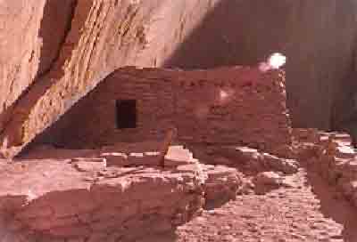
Defiance House ruins.
Photo: National Park Service

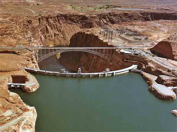
Lake Powell.
Photo: U.S. Bureau of Reclamation.
In 1956 the Colorado River Storage Act passed, and with it came the creation of Glen Canyon Dam. For years river runners had been making money taking tourist down the Colorado River to see the scenic Rainbow Bridge. A float trip down the 186 miles of Glen Canyon became a must do for adventure seekers, but now Lake Powell, the nation’s new toy, was bound to put these river trips out of business. Conservation came to the forefront of the ensuing argument for saving the canyon, but it fell on deaf ears. All that could be done was to try and catalog what was going to be lost underneath the water of Lake Powell.
In collaboration with the Museum of Northern Arizona, Jesse D. Jennings, an archaeologist from the University of Utah, instituted the Colorado River Basin Archeological Salvage Project. The project aimed to excavate all archeological sites before the water of Lake Powell submerged them forever. Although most ruins remained unexamined, the project was able to catalogue and map over 2,500 canyon sites ahead of the rising lake water. Today many people still remember the scenic beauty of the canyon that was lost. Now a new generation is being raised, not in a canyon, but on a lake instead.
Arte Greene was lucky enough to see the future on this growing desert lake, and in 1953 he leased some land from the state of Arizona that was to become the future shoreline of Lake Powell. When responsibility of the reservoir was given to the National Park Service he was in a perfect position to receive the first concession contract, and his company, Canyon Tours, was born. He dubbed the site of his new tourist operation Wahweap, after a nearby creek. Although the concession has changed hands over the years (currently in the possession of ARAMARK, a multinational service provider), Wahweap is still one of five marinas used by modern day boaters on Lake Powell.
Although the lake has been riddled with problems and controversy since its creation over silt aggradation, illegal dumping, and native species eradication, it has never failed to draw it fair share of visitors. In 1964, GCNRA had 196,400 visitors. In 1992, that number was just over 3.5 million. This number had far surpassed anyone’s expectations, but in more recent years vistation has trailed off. In 2008, the park had 1.9 million visitors. It might be that boaters do not want to deal with the more stringent regulations at the recreation area; or rather, maybe the novelty of the nation’s toy has simply worn off; either way Lake Powell is distinctly American. The decision to alter the nature of this place is now part of history, and it has become a part of American Culture. Stewardship of the reservoir has passed on to a new generation. David Brower, the President of the Sierra Club at the time of the lakes creation said that, “Emotionally, people are only able to look two generations back, and two generations forward…We need to see farther than that. It is inevitable…that Lake Powell… will someday be completely filled with silt.” The day is coming when America will once again have to change the nature of Lake Powell and Glen Canyon.
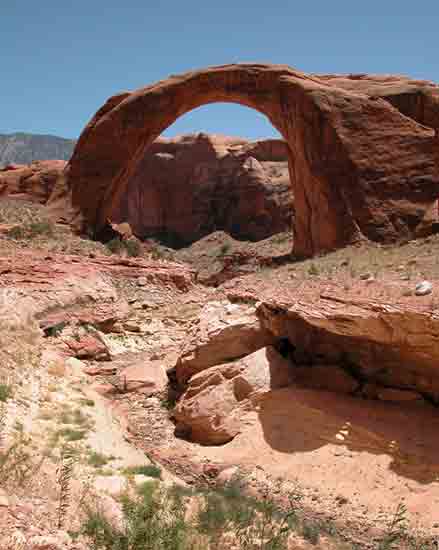
First viewed by western civilization in 1909, Rainbow Bridge is the largest natural bridge in the world. Standing 290-feet tall, it is equal in scale to the U.S. Capitol Building.
Photo: U.S. Bureau of Reclamation
Written By Mark Buchanan and Sarah Bohl Gerke
References:
- Benenati, Emma P. and Joseph P. Shannon. “Environmental History of the Colorado River: The Changing Focus of Science.” In Michael Anderson, A Gathering of Grand Canyon Historians, Grand Canyon Association, 2005. Pg 115-122.
- Billingsley, George H., Earle E. Spamer, and Dove Menkes. Quest for the Pillar of Gold: The Mines and Miners of the Grand Canyon. Grand Canyon Association, 1997.
- Bureau of Reclamation Glen Canyon Dam website: http://www.usbr.gov/uc/rm/crsp/gc/index.html
- Farmer, Jared. Glen Canyon Dammed. Tucson, Arizona: UP of Arizona, 1999.
- Glen Canyon National Recreation Area website: http://www.nps.gov/glca/
- Martin, Russell. A Story that Stands Like a Dam: Glen Canyon and the Struggle for the Soul of the West. Salt Lake City, Utah: University of Utah Press, 1999.
- McPhee, John. Encounters with the Archdruid. New York, Farrar, Straus, and Giroux, 1971.
- Murphy, Shane, Gaylord Staveley. Ammo Can Interp: Talking Points For a Grand Canyon River Trip. Flagstaff, Arizona: Canyoneers, Inc., 2007.
- National Research Council, Colorado River Basin Water Management: Evaluating
and Adjusting to Hydroclimatic Variability (Washington, DC: National Academy of
Sciences, 2007.)